Monday, April 25, 2011

Milford Sound and More!


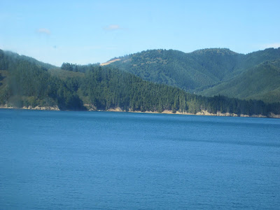
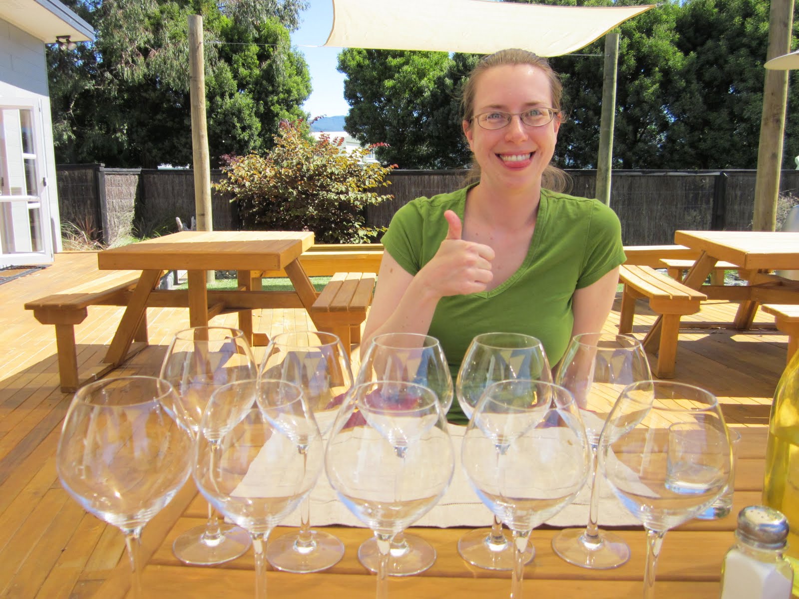
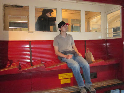
Our final major stop was Fiordland, but before we got there, we stopped for a night in a lakeside town that probably had the most beautiful setting of all the towns we visited. Wanaka is a small town situated by a lake surrounded by mountains that flow right down into the lake. The wind was so strong the seagulls were having trouble, but we walked around a bit and then headed into a bar with a view of the lake. After a pint, we got some not-nearly-as-good-as-Tauranga fish and chips and then got some sleep. The next morning, we picked up some meat pies for lunch later that day and then headed to Te Anau, our launching point for our Fiordland trip.

We arrived in Te Anau and ate our meat pies by the lake. I had chosen mutton because we were in New Zealand, and it was OK but very dense (which made it good for taking with us). Emily had chosen the tastier pepper steak. We checked that off of our list of foods to try, leaving only hokey pokey ice cream. We then made reservations for our trip to Milford Sound and checked in to our hotel to find that it also had a trampoline and a place to hang our laundry, just like Turangi. We did some laundry, explored the town, and even tried hokey pokey ice cream, which is basically vanilla ice cream with butterscotch in it. I am not a huge fan of butterscotch, but this was pretty good. It wasn't hazelnut gelato, but not bad nonetheless. That finished our list of foods to try.

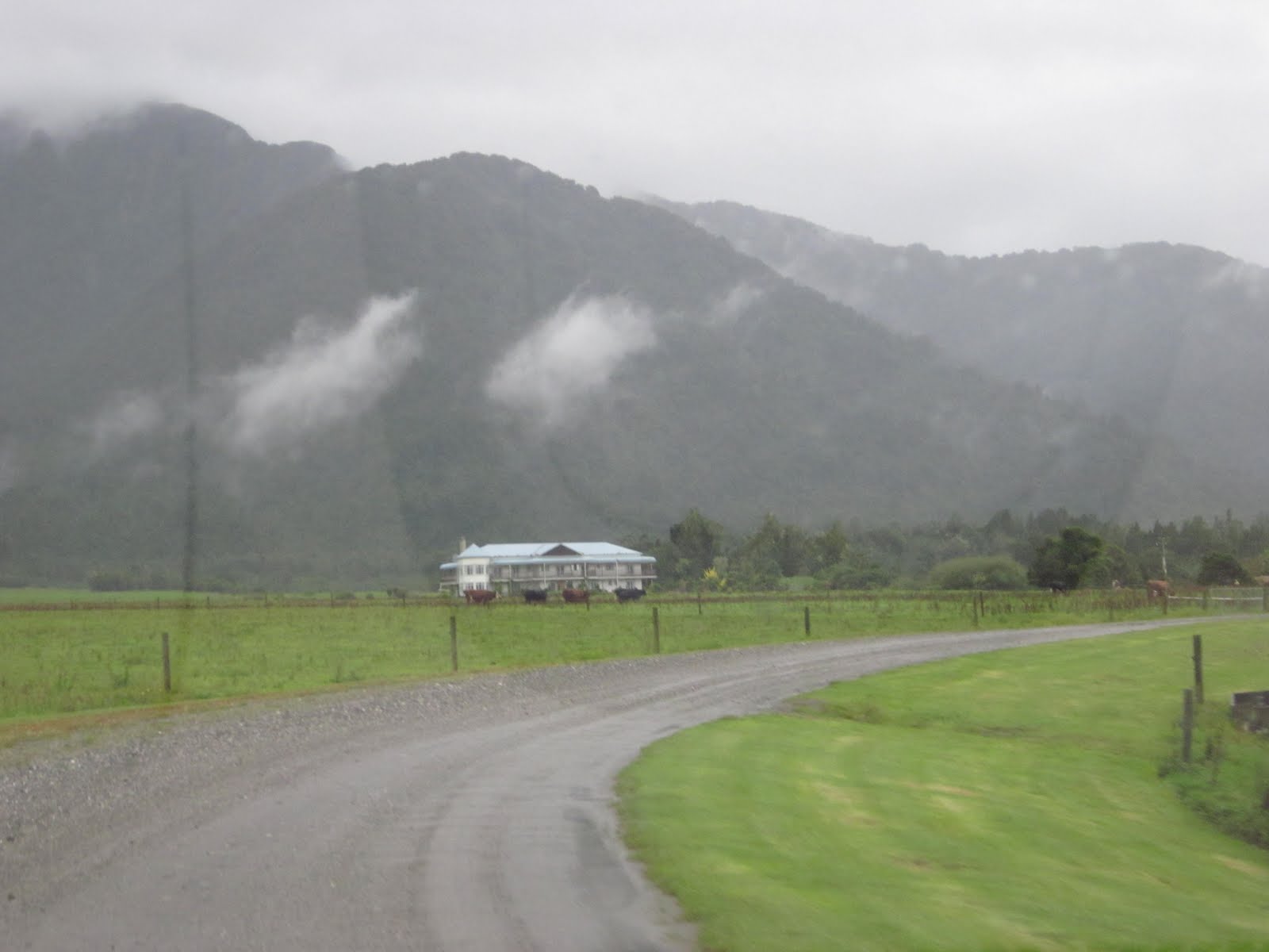
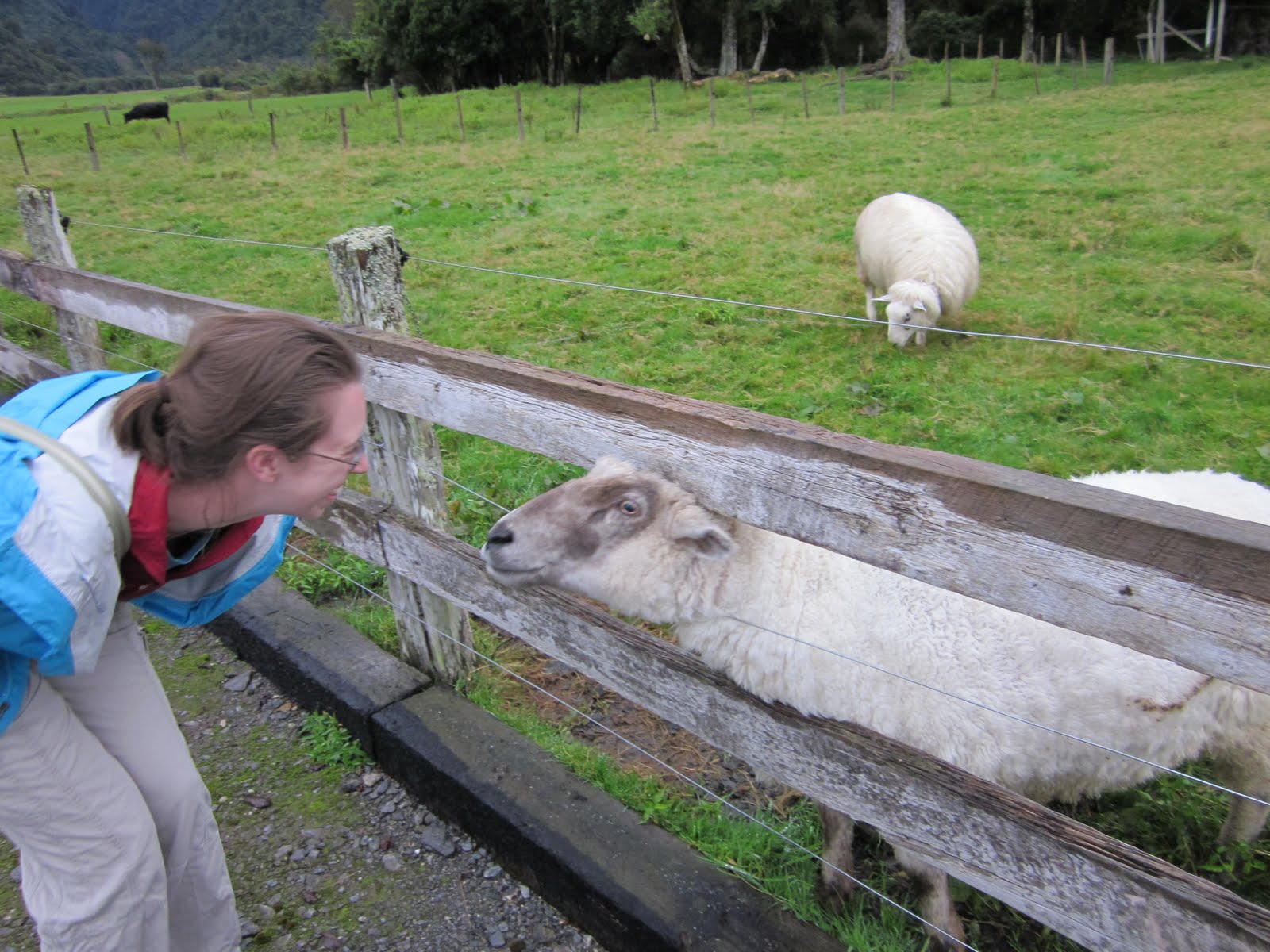
The next morning, our tour guide picked us up at our hotel at 8 am. By the time we were on our way, the van had some Brits, some Portuguese, and some more Americans. The two hour ride to the harbor was great for a couple of reasons. The first reason was that I was not driving so I could really enjoy the New Zealand scenery. The second reason was that the tour guide was an expert on the route since he drove it every day to deliver the mail. This meant he could provide us with a lot of information about the area, and he knew all the spots to stop for scenic views. We lucked out with the weather and were able to enjoy a sunny day, which, like the glacier, was not a given. On our drive, we stopped at an amazing meadow, some mirror lakes, and a one-way tunnel in which you actually descend as you progress through it.


A view of Lake Te Anau from one stop on the van ride.


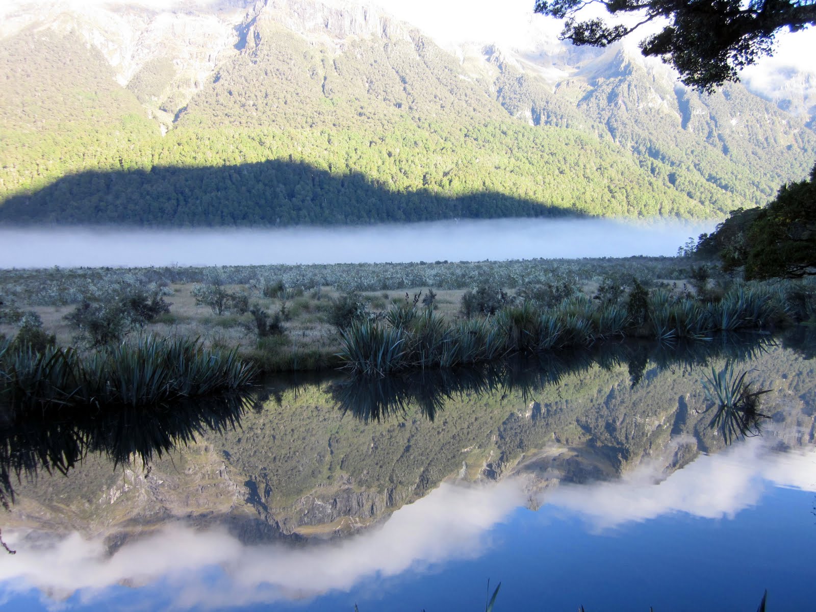
The Mirror Lakes were ripple free.


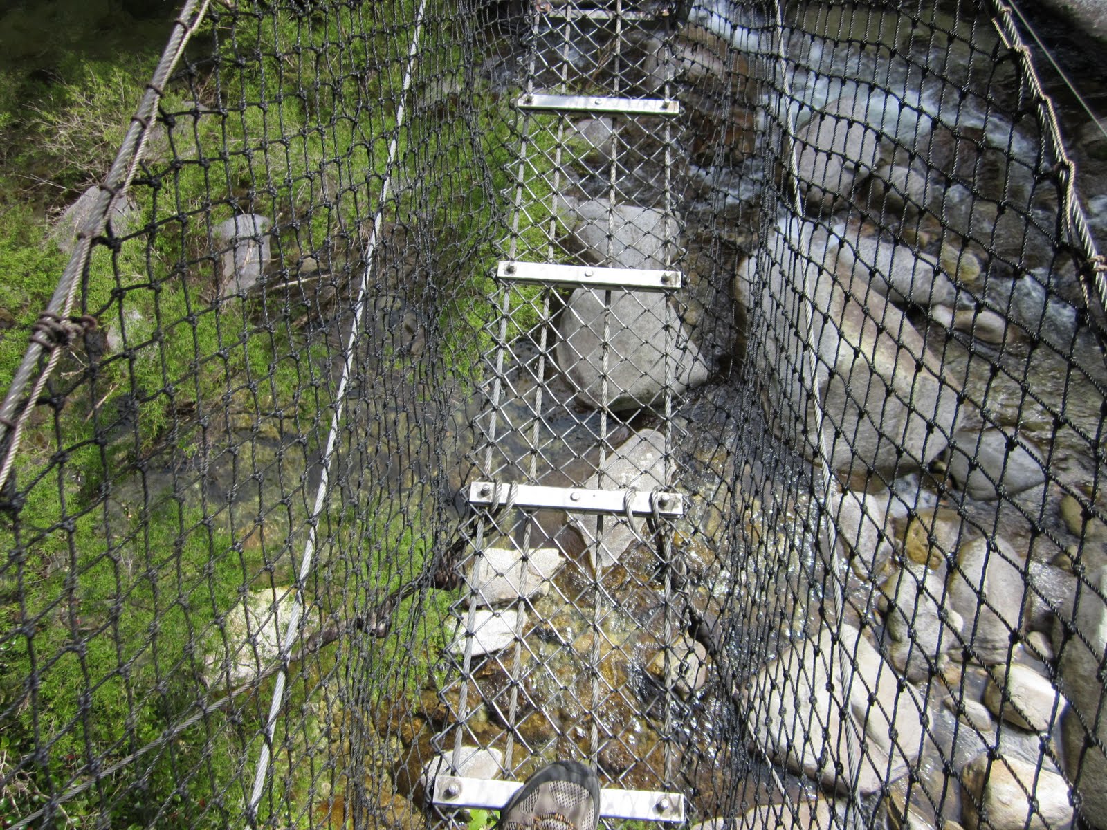
The sign before the one way tunnel left us enough time to get out and enjoy the mountain views.


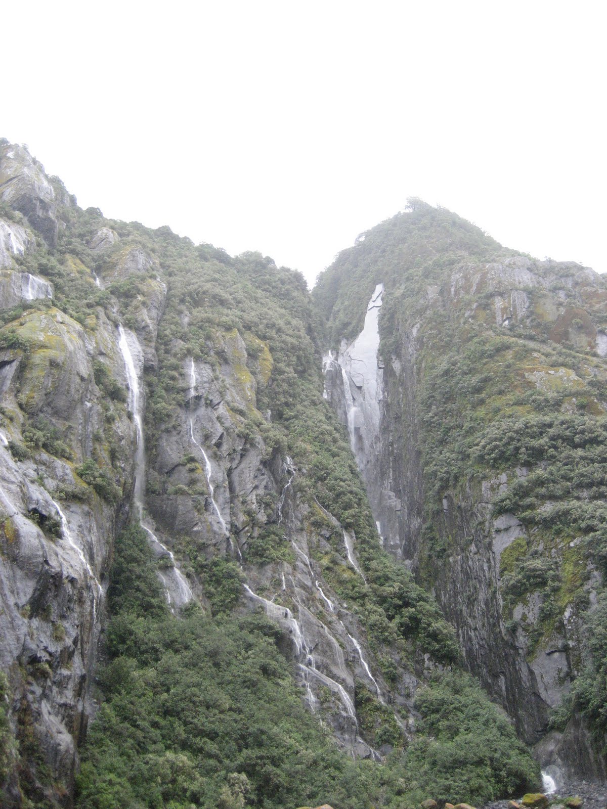
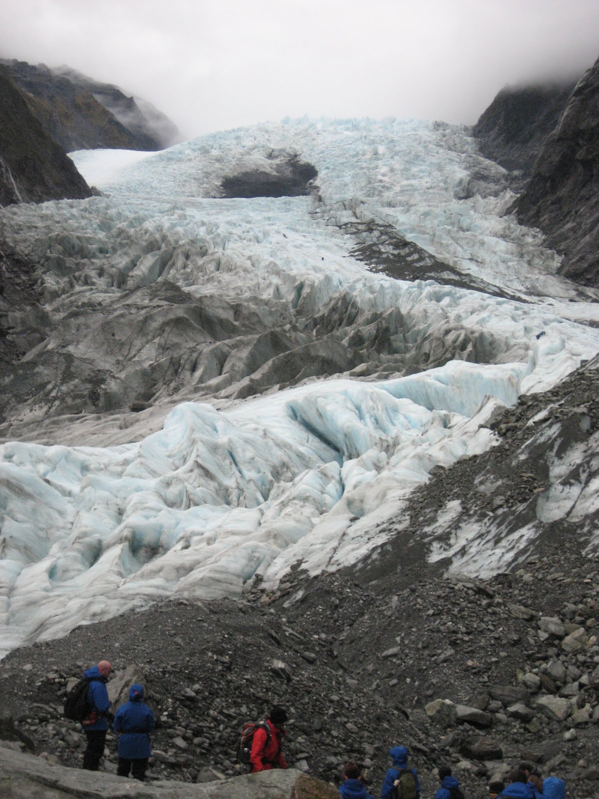
Once we reached the harbor, we boarded the boat and took our seats for the two hour cruise around Milford Sound. We learned that Milford Sound wasn't technically a sound because sounds are V-shaped valleys formed by rivers that are then filled by the sea. Milford Sound was actually a fiord, which is a U-shaped valley carved out by glacial activity and filled by the sea. Similar to the Franz Josef Glacier valley, waterfalls were plentiful and tumbled down the cliff sides. Our captain even drove the boat under a few. And unlike Tauranga, we spotted some dolphins. The most amazing aspect of the fiords is their scale. Being atop a mountain can provide a great view, but being at the bottom of a mountain or a cliff really makes you realize how big the land mass is. And we spent two hours at the base of a glacially formed valley.
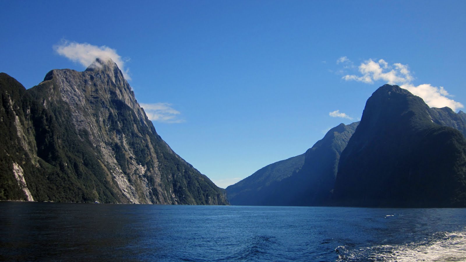

The Sound / Fiord.


Waterfalls abounded.


That's another glacier atop that mountain in the background. Looks like a patch of snow.


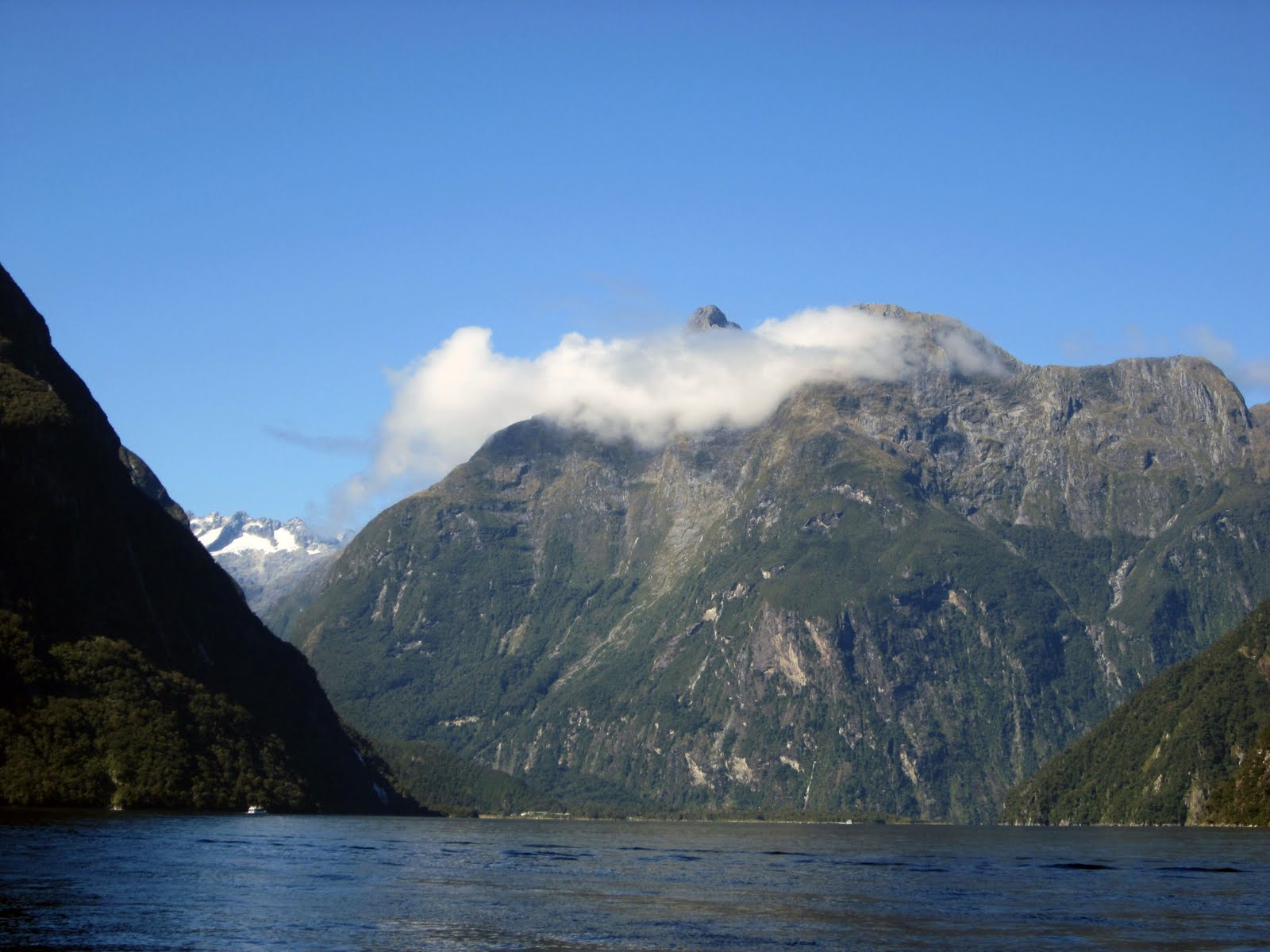
Clouds crowned the mountains.


More waterfalls!


This pic gives you some scale. That's a boat on the bottom left.


The kayaks at the bottom of this picture also provide some sense of scale.


Big waterfall and bigger alps.


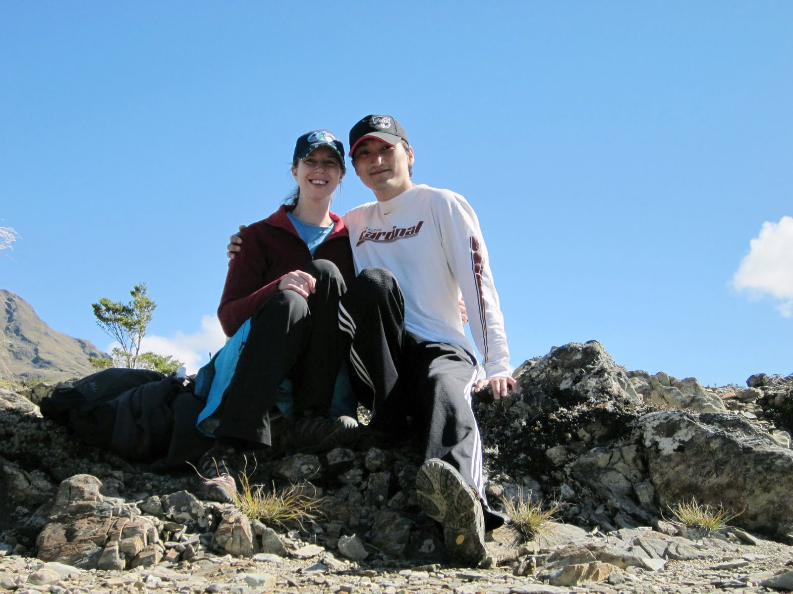
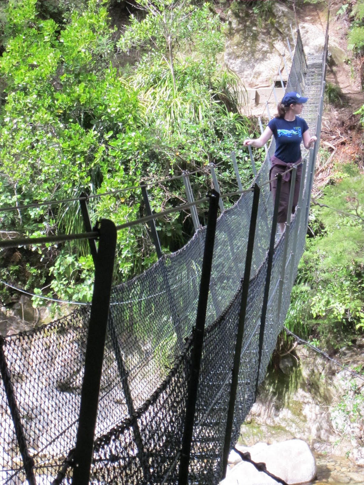
As part of our tour package, we were dropped off for a two hour round trip hike up a mountain to Key Summit, which is part of the Routeburn Track. After our experience with Tongariro Alpine Crossing, the hike up to the top was a breeze. The views were of valleys carved out by glaciers. We even caught a glimpse of a cirque while up there. The most important event to occur on Key Summit, and indeed maybe the whole trip to some people, was our engagement.

Emily and I have always arrived at decisions together and getting engaged was no different. After being a couple for six years, we had already decided that we would like to get married, and we thought New Zealand would be a great place to make our intentions official. While there were plenty of places along our trip to make public or grand romantic gestures, atop a volcano or a glacier or maybe deep in a glowworm cave (yeah, that didn't seem like a good idea), we are both private people and wanted to really make the moment our own.

We were in New Zealand, where Emily had always wanted to visit, and we had just spent a day cruising across a fiord, something I had always wanted to see. Though Emily (being the more practical of the two of us) did not want a rock, we did want to have a memento of our first official commitment to each other. In the town of Franz Josef, we had purchased jade pendants, each of which depicts two shoots growing together and represents the bonding of friendship. After our hike to the summit, we found a small setting off the path and gave each other the pendants. As we were talking, two doves flew up out of the bushes, a sign that we were making the right choice and belong together--OK, that didn't really happen because it wasn't a movie. Instead, we sat and talked about our future together, our families meeting, and some of our expectations in life. We then made our way back down the mountain, an engaged couple for the first time.


The view from Key Summit.


Another shot of the vistas.


The cirque was pretty cool.


Our first picture as an engaged couple.


We hung around Te Anau another day, where we finished up some shopping and enjoyed our first day as an engaged couple together. Actually, Emily came down with some flu bug and I had to finish the shopping on my own and buy her some soup for dinner. But hey, that's really what being married really is, right?--looking after each other. A week later, I would catch what she had and she'd take care of me.

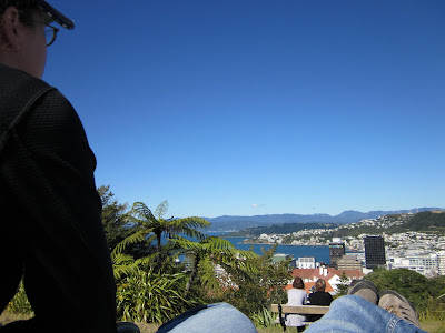
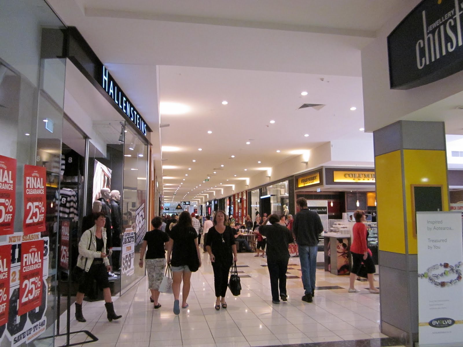
We enjoyed our time in Fiordland and spent the next couple days making our way back to the states. We spent an afternoon and night in Queenstown, which is another beautiful lakeside city. We wandered a park there and sat in a cafe along the main strip, where I had a beer and Emily a coffee. The next morning, we dropped off the Nissan Sunny at the airport by parking it and dropping the key in an unattended box. Our flight back to Auckland was easy, but we had selected a hotel near the airport, which meant we were stuck in suburbia for an afternoon. What do you do in suburbia? You walk to a mall, buy some smoothies, and then have some pizza for dinner, which is exactly what we did. Not exactly a crazy finish, but it got briefly exciting the next morning.

We had chosen our hotel (which was currently being improved to a sale-able level as the hotel manager/shuttle driver told us) because it offered a free shuttle to the airport. Unfortunately, the system they used to schedule early morning shuttles (a pen and paper) simply sucked. So, we awoke at 4 am to find that we had no ride. At least there was somebody at the desk to call us a cab, and we got there in plenty of time but we ended up paying for our cab. Don't stay at the . . . I don't remember the name of the hotel, so just avoid staying in Manakau if you can. We slept very little on the flights back, but made it to LAX, were greeted by my sister and niece, took a nap, had some dinner, and headed to San Diego the next morning to move all of our stuff out of a Pod. So, our trip did end kind of crazy--moving in to our new place super tired. And that, folks, was the end of our New Zealand vacation.

Sunday, April 17, 2011

Franz Josef Glacier


The second coolest (no pun intended) day in New Zealand, after the caves, was our tour of the Franz Josef Glacier. We drove from Takaka, back up that super scary road in drizzle. Luckily, it was only drizzle at that point; after that, it was pretty heavy rain the rest of the trip. With our Nissan Sunny wipers mostly working, we proceeded slowly, taking a full eight hours to get from Takaka to Franz Josef Glacier town. Of course, we took a route that was supposed to be one of the top ten scenic drives according to some list that must be wrong, and that took a little longer. From that drive, I decided two things: 1) scenic routes in the rain are not worth it, and 2) scenic routes are way better if you are not the driver. But we made it to our hotel, which was a renovated farm house with a sheep and plenty of cows nearby. They mooed all night.


You can see the cows lined up in front of our hotel as we approached.


Emily meeting one of the farm natives. The sheep was interested until she realized we didn't have food.


We awoke the next day to more drizzle and called the tour company to check if the weather would still permit our tour. They said yes so we headed to the office, where they gave people the option of rescheduling because the day could get wetter and colder than usual. After the chickens rescheduled, we received our gear, which covered us from head to foot: beanie, long waterproof and windproof jacket, wool mittens, waterproof pants, wool socks, boots, and crampons, which came in an red fanny pack. We then loaded onto the bus and headed to the start site.

To get to the glacier from the parking lot, we hiked about half a mile through a rain forest. There are three glaciers in the world that are situated right next to rain forests and two of them are in New Zealand: Franz Josef and Fox Glaciers. After the brief hike, we came out onto a field of broken rock called a moraine. Once upon a time, the glacier extended all the way to where we emerged from the forest. Later in time, during the glacier's retreat, the moraine was the bottom of a lake. But now it was dry enough to walk on. Our exit from the forest provided us our first view of the glacier, which didn't actually look that far away. However, we had a solid mile to hike in our boots that weren't all that comfortable.


Exiting the rain forest provided a spectacular view of the glacier's terminal face, which looked like a frozen river.


The hike across the moraine, though subject to a bit of drizzle, left little to be desired. The rocks on the valley floor had interesting textures and patterns from being ground under a glacier. The moraine was walled on both sides by steep granite mountains covered in rain forest foliage. Tens of waterfalls tumbled down both walls to the valley floor. And straight ahead was our target, a flowing mass of ice that wove its way down into the valley between two walls of granite.


I took a lot of pictures of rocks because I was a bit mesmerized by them. If you think this picture is boring, be glad I didn't post all the pictures of rocks I took.


Waterfalls fell from the tops of some cliffs surrounding us.


Here's what I remember about the glacier from the guide. The glacier consists of two main parts, the terminal face, which is what we could see and would hike, and the neve, which is where the glacier is fed. As moist air is blown in from the ocean to the west, it rises quickly as it hits the Southern Alps. Water condenses and snow falls onto the neve on 200+ days per year at an altitude of over 8,800 feet. This creates a huge ice pack under great pressure that is released by flowing into the valley, which is at an altitude of 800 feet. The huge drop in altitude that happens over about 6.5 miles and increases the temperature so the glacier is constantly melting on its terminal face. I don't remember how fast our guide said the glacier moves nowadays, but in the past, it has moved at rates of 70 cm per day, which is ten times faster than a normal glacier. The result is that it is constantly changing, melting and being resupplied by the neve. Come back a year later--completely different. A week later--very different. Two days later--the ice cave that was there before may be gone. It made what I always considered of a geologic feature (I know--it's made of ice, not rock) feel very alive, moving on a fast timescale for geology.

On our way across the moraine, we stopped to gaze at some of the more impressive waterfalls and the river that was exiting from the glacier. The river water was gushing from the opening, and it carried rocks that crashed into each other on their journey, giving the water a dirty but milky brownish color.


Some more waterfalls.


The river exited the glacier at high speed and low temperature. This picture also starts to put the glacier in perspective if you notice the tiny dots of people on the hill to the right.


We then proceeded to cross the rope fence that was meant to warn unguided visitors of danger. Uphill for twenty minutes and then it was time to put on our crampons, meaning it was time to get on the ice. They were surprisingly easy to lace up.


This is one of the signs warning people to take a guide with them.


Up a scree hill for a bit.


The view from the top of the valley made the first little hike well worth it.


Lacing up the crampons.


I used to think those old metal golf spikes were aggressive.


We needed crampons because we were about to jump onto this.


Hiking up the ice was made much safer by the work of our guides earlier in the day. They spent hours each morning cutting steps into the ice, which allows groups to get to higher elevations. We were on the ice for around two hours, and in that time, we saw some really awesome formations and views. Even the pictures don't do them justice, but they are better than me typing about them. Another bonus was that the rain stopped, and it was pretty warm for the glacier. We even got rid of our hoods and mittens.


A little bit of perspective on how large the terminal face is. Notice the guy in red on the top in the center.


We saw an awesome ice cave, but weren't allowed to enter because it could collapse at any time.


Some of the ice looked like it was whipped into its shape by beaters.


Some ice looked very aggressive.


Regardless of how cold the terrain was, the views were always amazing.


We didn't hike all the way up, but it looked pretty rugged.


We even got to hike through a tiny crevasse.


This is what the crevasse looked like from the other end.


After expecting to get super cold and wet, I was pleasantly surprised by the good weather and how spectacular the entire glacier experience was. I would return in a heartbeat to see it again because it would be a completely different surface to explore. Happy with our day, we wandered around town and eventually headed to bed, sleeping through the lowing of the cows. Our next big stop was fiordland, which proved to be every bit as impressive as I imagined it would be.

Saturday, April 16, 2011

Abel Tasman National Park

The ferry ride from the north island to the south island was interesting because it wasn't a simple straight shot from port to port. On both ends, the ferry had to weave around islands, which made it much more scenic than expected. After driving off the ferry, we took a long and winding drive to get to the northern border of Abel Tasman National Park. The road was of course two lanes and the one side went pretty much straight down--a long way down. It was so scary, our camera battery died, preventing us from getting any pictures of it.


This was taken from the ferry--looking out the front. We had to dodge a lot of little islands, which made the ride scenic--while I was awake.


We stayed in Takaka, a town that was vying for smallest village to house Andrew and Emily. The plan was to get up the next day and kayak down along the park. Unfortunately, the sea was too rough the next day, so they weren't letting people out in kayaks. Not a lot of luck with the ocean activities for us in New Zealand. We were of course a little disappointed, but we went to Plan B, which was to make a plan.

After stopping by the local iSite, which are tourist centers conveniently located in pretty much every New Zealand town, we figured out what to do. First stop was the "dancing sands," where one could see the largest natural springs in New Zealand shoot dirt off the floor as they well up from the underground vents. It turns out, the sands weren't up for a show that day. So, even though the water was really clear, we really didn't see much on that little hike. Pretty much anything that had to do with water in New Zealand besides the caves did not want us to see it.

This face sums up how we felt about the "dancing sands," which would have gotten slammed by the "So You Think You Can Dance" judges. We did see a cool reverse periscope thing though, which let you see under water. A cool concept, but we didn't see much in that thing either.


No bother, we had another stop lined up: the Labyrinth Rocks. The limestone rocks were carved out by water and open to the sky so you could wander through them without any danger. They were interesting rock formations, but people had "decorated" them with tiny figurines, which kind of detracted from the experience. The figurines and the facts that we were the only ones there and the rocks were kind of a maze made the whole experience a little creepy.


The labyrinth rocks came in cool shapes.


Look! It's rocks . . . making a labyrinth.


Stop number three was a two-hour, round-trip hike into Abel Tasman National Park to a waterfall. The path started with a high density of cows so you knew coming back when you were nearing the end. The hike wasn't too difficult, and we did get to walk on a one-person suspension bridge, which was a little scary but fun. The path led to the bottom of a waterfall, where we sat and had some snacks before heading back.


My memory has the view from this bridge being a little scarier than this photograph is showing. But you get the idea.


Emily had no problem crossing and enjoyed it.


The waterfall was no Niagara (I assume since I haven't been there), but it seemed bigger when we were there.


Next stop: lunch. All of the towns around Takaka had restaurants with plenty of space for people. However, they were all empty because it was off season, meaning we often had them to ourselves. Our lunch spot was no different. We checked green-lipped mussels off of our food list. I'd like to say they were the best mussels I've ever had, but those would be from Passion Fish in Pacific Grove. However, they were the prettiest and the biggest ones I've had.


Green lipped mussels did not actually have lips, which would have been a little creepy to eat.


After the hike, we decided to check out the beaches, which were different from other beaches that I had seen. During our drive to the kayak spot, we saw four or five beaches that essentially disappear when the tide comes in. They are so flat that they are completely covered. There are a couple of similar beaches on the Abel Tasman Track that make the path impassable at certain times of the day. While they weren't the amazing white sand beaches of the Caribbean, I found them very interesting. We walked along one for an hour or so, watching the birds dig for clams and enjoying the views of the tree-covered cliffs.


In the very center of this picture there is a rock. Note how faraway it is from the waterline.


This is the rock close up, where lots mussels happily live. The water comes in pretty far during high tide.


Me standing on the rock. Not a bad sky.


Our ad hoc day ended with a bottle of wine we bought from the winery in Turangi, some internet, a bad movie, and some Top Gear. It turned out to be a pretty great vacation day, despite it not going exactly according to plan.

Thursday, April 14, 2011

Natural springs, a winery, and more city parks

Having crammed so much adventure in so few days, we decided we needed a bit of a respite. After all, we were on vacation. Once we left Tongariro, we headed to a small town about an hour away called Turangi. In 2006, the population was a little over 3,000. It reminded me of the Midwest, except that there were small mountains surrounding it. But the smell, the town size, the friendliness of our hotel owner, and the free laundry all made it feel somewhat familiar. And it had a trampoline! But I was not super interested in that given the state of my knees.

We checked in to our quaint hotel, gingerly made our way to get some fish and chips, and then settled down to rest. The next morning, we slept in and then headed to some hot springs to soak our sore bodies. About ten minutes away was a place where you can rent a private room that has natural hot spring water pumped into a 8 X 8 cement pool. There were ample warnings to avoid submerging your head to avoid some horrible disease. But the pool felt really good after our hike the previous day. We left the springs feeling refreshed and walked a short, flat path to check out the other hot springs. I got caught up trying to take action shots of bubbling mud. I think you'll agree it was well worth my time.


The thermal pool was nice, hot, and smelled only slightly of sulfur.


Amoebic meningitis? And we thought the caves were an adventure. Here, we had to hold our heads above water for the entire 20 minutes!


I know--an amazing shot. This is one of about fifty pictures I took to catch the mud bubble action shot. Days later, I found the camera function for taking a series of photos.


Our next stop in Turangi was a winery, where we had some lunch and did some wine tasting. The food was pretty good and the tasting was interesting. Instead of trying a bunch of different types of wine, they had us try different vintages of the same grapes, which we had never done. A relaxing lunch in the shade on a nice day. Then, while our laundry dried in the sunny afternoon breeze, we took a stroll along the local river, where we watched some old guys fly fish and some young kids swim across the river. It was like a modern day Mark Twain book. I did a little bit of jumping on the trampoline because it was a novelty and then we headed to bed.


Roasted tomatoes and squash, mushrooms, sausage, poached eggs on toast. Simple but delicious!


Don't worry, only half of these were for Emily.


Hanging the laundry added to the small town feel. Emily also of course hung laundry, but the shot of her has my underwear in the picture. We only want so many pictures of my underwear on the internet.


The fly fisherman in the river was idyllic (though I'm not sure he knew what he was doing--he didn't look anything like Brad Pitt in "A River Runs Through It").


After a relaxing day, I was ready to jump on the trampoline. How many hotels would we be at with a trampoline? Well, one more in New Zealand.


The next day, we drove couple hours farther south to a town called Palmerston North, where we hit a mall and a city park. I have to admit that I like visiting malls in foreign countries because, to me, indoor malls are so closely tied to American teenage-dom. So, I like to compare them. But usually, as was the case in Palmerston North, they are pretty similar to the ones in America but with different chain stores. Oh well. Next stop in Palmerston North was a city park, which was pretty nice. It had a tiny train that people could ride, a botanical garden, where I saw pitcher plants for the first time, and a bird display with some native birds. I have to say that most birds endemic to New Zealand are a bit sad evolutionarily speaking, which is why they didn't do so well when man arrived. However, they are interesting looking sometimes (read "kind of ugly" until you learn to appreciate them), like with the Kea, a giant green parrot. Palmerston North was a nice little stopover on our way to Wellington, which was mostly a stopover on our way to the south island of New Zealand.


Look! A mall. It looks so . . . much like a mall in the US.


Giant Emily? Or tiny train track?


The kea was green and pretty large.


The next day, we drove to Wellington, where we grabbed lunch at a trendy cafe near the harbor that had terrible service but pretty good food. We also visited the city park, which we arrived at by taking a funicular up a mountain. There was a stop in the middle of the hill for the university, which I thought was cool. The view of the city from the top was pretty amazing and we wandered around the gardens. They had a hot house like Palmerston North, where they also had pitcher plants. But in Wellington, they were gigantic, and they also had Venus fly traps. I spent a lot of time looking at them. We also found the funicular museum interesting. I know what you're thinking: He just said that a museum about old cable cars was interesting--what a loser! And if you're not thinking that, but instead you are wanting to know more about the old funiculars, you are a total loser! But seriously, the museum was way more interesting than I expected. Funiculars are very clever engineering solutions.


Our brunch location wasn't too bad.


Relaxing with a view.


Carnivorous plant!


Huge carnivorous plant!


The old funicular had clever seats.


The modern funicular coming towards us.


Bare feet were more common than we expected.


Departing Wellington literally meant departing the north island for the south island, but is also represented, to me, our transition from the first half of our trip to the second half of our trip. The second half had events spread out, included longer drives, and had us staying in less populated areas. That was a little concerning, mostly because there would be a greater number of isolated areas where the Nissan Sunny could break down.

Our first step to getting to the south island, making the ferry on time, did not go exactly as planned. We were supposed to arrive at the ferry terminal with our car ready at 7:15 am or something like that. So, of course we set the alarm on a smart phone and an alarm on the iPad for the correct time. Both were still on California time. Unfortunately, our smart devices were a little too smart and adjusted for daylight savings that night. Even though clocks were changing in the US, they were not changing in New Zealand. Fortunately, clocks stateside were springing ahead so we ended up rising an hour early instead of an hour late, which would have been much worse. Still, we were a little grumpy that Apple had kind of messed us about. We made the ferry easily and were on our way to the south island where we would visit Abel Tasman National Park, a glacier, and fiordland.


The Wellington harbor an hour earlier than we wanted it to be.