Wednesday, April 13, 2011

Tongariro Alpine Crossing (Let's see how unfit we are)


One day, eight hours, 12 miles (19.4 km), a climb of almost half a mile (765 m), a descent of seven tenths of a mile (1,126 m). Numbers were just numbers until our lungs realized what they meant during the ascent and our knees felt them the day after. Yet, the numbers were often pushed to the backs of our minds as we walked alongside massive volcanoes, red craters, and emerald green lakes. Tongariro Alpine Crossing was a beautiful hike that convinced us of two things: 1) we were not in good shape--thanks, grad school, and 2) we would like to do more hiking in the future.

We caught a shuttle at 7:00 am to the beginning of the Crossing; and by "caught a shuttle," I mean that the owner of the hotel drove us in our Nissan Sunny to the starting point because the shuttle bus had dropped off a bunch of people at 6:30 am. Interestingly, our driver used to run races near Notre Dame and had run the entire route we were about to hike in less than an hour and a half. The night before, we had been advised to wear multiple layers and waterproof outerwear. The beginning of the hike was chilly, but we soon warmed up. For about an hour and a half, we hiked a gradual incline through fields of tiny white flowers, brush, and jagged lava formations. Then we came to the warning sign, letting us know that things would be very tough from that point on.


Lava rock formations looked like large chunks of chocolate on the field.


White flowers looked like layers of marshmallow. We just needed something that looked like a giant graham cracker to have a S'more-y landscape.


Before the first ascent, we were warned that the rest of the hike would not be simple.


The first major ascent provided us with great views of the lava rock-filled valley we had just hiked and mountains in the distance. Our nemesis soon became the wooden stairs on the climb that forced us to take the same size steps over and over. We would pass people who were taking a break, and they would pass us a few minutes later as we rested. But the rests gave us time to enjoy the views.


A view of the valley from the first ascent.


The stairs probably reduced erosion but increased difficulty for us.


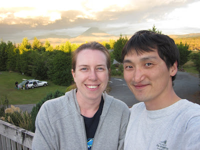
Eventually, we finished the first ascent and had a snack while sitting right next to Mt. Ngauruhoe, also known as Mt. Doom to Lord of the Rings fans. There was a "path" up to the peak of the volcano, but we wanted to finish the hike without becoming too familiar with a giant, slanted scree field. But Mt. Ngauruhoe was impressive to see in its barren massiveness. The first picture of the post shows it.

After climbing through so much rock covered landscape, our next leg felt strangely empty and surprisingly flat. The South Crater was completely different in that it was a giant valley of packed dirt. I liked it because its flatness and nakedness reminded me of a moonscape. Unfortunately, it was followed by the second ascent that lacked nice wide stairs, which were replaced with loose dirt and rock along a narrow trail. I wouldn't say it felt dangerous, but the there was just enough uncertainty that it took my mind off of my unfitness. It took us past the Red Crater, which was a steep, uh, crater that was, uh, red. Despite my description (or the description of the guy who named it), it was actually very impressive.


Us in the flat South Crater.


The second ascent began after the South Crater without any tidy stairs.


The view of Mt. Ngauruhoe from the second ascent


The Red Crater was indeed quite red.


Emily checks out the Red Crater.


After the Red Crater, we reached our highest point on the main route at 6,187 feet, which is a little higher than Denver. There were two higher side trips up Mt. Tongariro and Mt. Ngauruhoe that were possible, but we were doing well enough to make it up the main route. Our descent required even more care than the second ascent because the path was loose dirt and rocks all the way down a steep incline. Some people chose to take the loose rock path, but I found that walking in soft dirt decreased the chances of slipping. The initial hike down was made more difficult by the amazing views of the Emerald Lakes, which drew your eyes away from the path.


After passing the Red Crater, we saw geothermal steam, the Emerald Lakes below us, and Blue Lake in the distance.


The descent towards the Emerald Lakes was a little precarious.


The Emerald Lakes were quite a sight though.


After managing the slippery initial descent, we hiked across another crater called Central Crater and had a picnic lunch of pita bread, salami, and trail mix next to Blue Lake. We felt good having the strenuous parts behind us.


We decided to eat the food we packed in by Blue Lake.


Not a bad lunch time view.


In the other direction, we could see Red Crater in front of Mt. Ngauruhoe.


The rest of the descent consisted of long, winding switchbacks of packed dirt. And since the endpoint was lower than the starting point, we had to descend even farther, which was not great for our knees. The final mile or two was wooded forest that finally opened up into a parking lot. We waited there for about 20 minutes until our shuttle picked us up and took us back to the hotel, where we settled the bill and drove to our next destination, Turangi, where we planned on doing some relaxing.


The descent after lunch also provided some great vistas.


The switchbacks were long and gradual; our knees would have preferred a little less downhill.


A chart at the end of the hike showed our elevation changes. We actually started on the right side of this graph.

Sunday, April 10, 2011

Dolphin Desertion

It was 4 o' clock on a Monday when we arrived in Tauranga, glad that we had made it through an hour of tortuous roads. We drove straight through downtown, which was quiet--a little too quiet. As a tumbleweed rolled across the--OK, that didn't happen, but in the middle of town on the main strip, we were just about the only thing moving. We decided to check in at our hotel to see if anybody was there. The hotel was a little on the old side and normally served as a conference center, which meant that it had plenty of rooms. It's emptiness, size, and woodiness reminded me a bit of The Shining. And then there were the creepy twins. Well, there were no creepy twins, but we probably saw ten other people the entire time we were in the hotel.

After checking in, we decided to venture out to get some headache medicine and dinner. While looking for a drug store, we heard the slow beat of drums: pum . . . pum . . . pum. As we walked, they grew louder and louder: PUM! . . . PUM! . . . PUM! As we rounded the corner, my heart leaped into my throat--well, not really. We had found the reason the entire town felt empty. It was a parade! Almost everybody had closed shop to walk and collect money in a parade supporting their fellow New Zealanders in Christchurch, who were suffering from the earthquake that had hit three weeks earlier. As they walked through the closed off streets, people put money into the buckets firemen were carrying. I hadn't seen anything like it: a whole town shut down to support a city on a different island. Everybody was dressed in a red and black, and the atmosphere was actually festive.


The parade to support Christchurch was full of people in red and black.


We walked with the crowd for a little bit until we found a pharmacy and bought some Panadol, which is basically Tylenol. The big difference was that Panadol's expiration date was about two weeks from the date we purchased it, which seemed a bit ridiculous. We then grabbed one of the foods on Emily's New Zealand eats list, which included green-lipped mussels, fish and chips, kumara (a sweet potato-like root), hokey pokey ice cream, and meat pies.

Our meal was the best part of Tauranga for me and so so so good. I've had fish and chips a number of times because fried fish and fried potatoes sounds like it should taste almost as good as fried snickers. Unfortunately, I have usually been unimpressed. But not this time. Emily had read about a fish place where you line up, order, and then wait twenty minutes for them to get to your order and fry your fish and chips. It was well worth the wait. We sat down by the harbor and opened the newspaper wrapping that we received over the counter. The batter was crisp, the fish fresh and flaky, and the whole fillet felt melted in my mouth. And it didn't sit in my stomach like all the other fish and chips I had eaten. It felt lighter, even after eating the fried goodness. The only curse was that I would continue searching for fish and chips that tasted as good during the rest of the trip. I did not find it.


Fish and chips? Try DeFishous and Chips. I tried to get this word to catch on with my nephew when he was three. I will keep trying.


The next morning, we arose early to get to the dock for our trip to swim with dolphins. We tried on wet suits and flippers, which would have been necessary if we sighted dolphins and the captain decided conditions were good for swimming with them. I won't dwell on this part of the trip because it makes me a little sad, but we boarded the boat and returned 5 hours later, having not seen a single thing in the water. For our money and time, we got a tour of the Bay of Plenty, some breakfast biscuits and tea, and the captain telling us about how rare it was not to see anything and how he could not explain it because the day before was awesome--he mentioned this multiple times. So, like the town the evening before, the sea was apparently deserted. The captain said a day without seeing anything happens only 2% of the time. We should have bought a lottery ticket that day. Even though we could have stayed around a second day to try to swim with the dolphins for free, but we had a lot more to see. I hear swimming with the dolphins is amazing, and so next time we will try a place called Kaikoura, where our friends had accomplished it. We had tried Tauranga because it had fit into our schedule a little better.


Our Seafaris ship. Get it? Like a safari but in the sea.


We did see a nice view of this island in the Bay of Plenty.


This cloud was the closest thing to a dolphin that we saw. Even the sky taunted us.


When the captain told us he was giving up, we were sad. When he told us exactly how infrequently this happens, we were even sadder and made these faces.


After our poor luck on the sea, we hope our next journey on land would be more successful. So, once we docked, we grabbed some much needed lunch and drove three hours to Tongariro, where we ended the day on a happier note. We were ready to hike through a volcanic landscape.


At the end of the day, we made it to our next destination, which made us happy. You can see our volcanic objective for the next day in the background.

Wednesday, April 6, 2011

Te Whakarewarewatanga O Te Ope Taua A Wahiao


In Rotorua, a couple hours from Waitomo, we visited a Maori village built on geothermal pools. The Maori were the indigenous Polynesian people of New Zealand. Their village, called Te Whakarewarewatanga O Te Ope Taua A Wahiao or "The Gathering Place of the Army of Wahiao" or just Whaka for short, was an interesting mix of past and present. While a few replicas of old stick huts that the natives used to inhabit remained, much of the site contained more modern homes with electricity and glass windows. The tourist destination was still inhabited by the Maori and the geothermal pools on which the town was built were still in use. We took the tour.


Emily standing next to a normal sized sleeping hut of the Maori.


The village was situated on a hill, and you could see steam all around and many hot pools. The smell of sulfur filled the air and heat emanated from the ground. If that wasn't enough to convince a you that you were on a hotbed of geothermal activity, you could see two geysers spewing a few hundred yards away.


Steam was everywhere between the houses!


Prince of Wales Geyser, one of two visible from the village.


The most amazing thing to me was the fact that the natives still used the pools to cook and bathe. While we did not witness anybody bathing in the tubs they fill once a day with mineral-laden water from the pools, we did get to see some cooking. There were two methods used for preparing food. The first method was steaming, which the residents accomplished in a wooden box with a lid that was placed over a steam vent. As we were walking, a person actually set her dinner in the box to cook or reheat it. The second method was boiling. Locals would take some cheesecloth, put some frozen corn or chicken in it, tie the top to form a bag, and then suspend the package in the hot pools for some time. Frozen corn took four minutes and a frozen chicken an hour and a half. Not bad at all.


Spring water would flood this area en route to the bathtubs located to the left of this picture. Colorful mineral deposits were left behind after evaporation of the water.


A steam box for cooking.


Our guide demonstrating the rig for cooking directly in the hot springs. You could even vary your temperature a little based on the depth at which you cooked. The person who put this bag together came to retrieve it while we were standing there.


We also saw a traditional show where the villagers demonstrated some Maori dances and vocal talents. Four men and four women sang in their native tongue and quite impressed me. They also demonstrated some stick skills that have been passed through the generations and originated as demonstrations of warrior prowess. The show also contained the Haka dance, which is a warrior dance that you may have seen in "Invictus." They pulled some guys onto stage and we got to laugh while they tried it. Throughout the dance and the entire show, the guys from the village made their popular traditional faces with bulging eyes and tongue stuck out. When I try making the face, it looks more stupid than scary. The performance is maintained through the generations by kids learning the moves and then replacing the elders as they retire. It may have been aimed at tourists, but it did not feel overly produced like some shows.


One of Maori women demonstrated dancing with a "poi," which is a ball on a string. With it, she made cool percussion sounds during her song by hitting her hands as she swung it through the air.


After the show, we took a walk around the area to see the other hot springs and the mud pools that bubbled up at various places in the village. If memory serves, our guide said there were around 25 hot pools, which were all very clear. Once we had our fill of the village and its geothermal activity, we headed off for a day of swimming with the dolphins--or at least our attempt.


A view from our hot springs walk.


Us on our hot springs walk. Look at that hot stuff behind us!

Monday, April 4, 2011

Glowworm Caves

After a one and a half hour drive from Auckland to Waitomo, we checked in and headed to our happy-sounding Black Abyss Tour with the Black Water Rafting Company. Once we realized what we were about to do--rappel into a black abyss--we got a little nervous. We also realized that we did not know what else we would have to do besides rappel into a dark yawning cavern of death. Would we have to squeeze through spaces the size of a trash can for kilometers on end? Would we get stuck behind somebody not quite wide enough to fit through that space? Our lack of knowledge hit us as we signed what would have been a liability form in the US. Instead, it was a form just letting them know what health issues we had so the guides could ensure we didn't do anything too dangerous to our health. Nothing on there about a healthy fear of squeezing through small spaces.

We showed up with our bathing suits and towels because all of the equipment for the five hour journey was to be provided for us. We departed the station with gear that included wet suit, wet suit socks, wet suit jacket, sturdy rubber caving boots, helmet with a torch (flashlight), a harness, and rappel gear. A quick ride to the entrance of the cave and a fifteen minute lesson on how to stay alive while rappelling was all the time and prep we had before descending into the Black Abyss of Doooooom!


Obviously, this is not in the cave. Emily testing her rappelling gear (top, in the middle). Me, testing my gear (bottom, on left), and getting considerable air, if I do say so myself.

To enter the cave, we rappelled, or abseiled as they say in NZ, straight down 120 feet into a pit, which shrank to an opening wide enough to squeeze through and then opened up into a decent sized atrium. I had imagined a situation where we dropped into a wide open dome lit up by dwarf torches and glowworms, but instead I descended with a wall on one side of me and little more than a headlamp to see where to place my feet. We thought the rappel would be the most adventurous part of the day, but we were wrong. In fact, after being members of a climbing gym for a couple of years, rappelling seemed straight forward and extremely safe.


Into the rabbit hole.

Once the group had reassembled in the darkness at the end of our descent, we made our way along a stone corridor, avoiding still-forming stalactites and stalagmites. Then, one by one, our guide hooked us onto a zip line and told us to kill our headlights. We each flew through the black with nothing visible but glow worms on the roof of the cave. I think I would have enjoyed the ride more if I wasn't concerned about whether or not they had rigged the rope to avoid every single rock feature. I'm pretty sure I was tucked in like a potato bug.

This isn't anybody we know, but this is the zip line we rode--with no light. See that rock on the right? What if I had been turned? Probably no big deal, but I say tucking was a good idea.

We reassembled below and then sat along a ten foot cliff with an underground river running at the base. Our guides, both named Andrew but going by the handles Monkey and Drew, gave us a snack of hot cocoa and honeyed muesli. They wanted us to warm for the next leg of our journey: riding in an inner tube on the underground river. We were assigned inner tubes and then informed that to get into the river, we had to jump butt first from the cliff. I'm not a huge fan of jumping into bodies of water with a bottom I cannot see, and I could barely make out the top of this body of water. Of course, I was up first, so I affixed the inner tube to my rear, hoped the my guides were right, and jumped. I'm sure the impact was better than landing on the jagged rock that lined the bottom of the river, but it was still a bit jarring. In fact, the guides later told me that somebody with a weak back once broke her back on that jump. The idea behind the jump was to get everybody's wet suit full of water so it would work. But it took awhile to warm up since you basically sat with your butt hanging in the water.

Again, this isn't us, but this is the cliff we leaped from.

In the water, we pulled ourselves down the calm portion of the river using a rope attached to the wall. Our destination about ten minutes later was a high-ceilinged area where the glow worms above looked like a starry night. It was here that Monkey explained that glow worms are actually maggots of a fungus gnat fly. He explained that "caves of glowing maggots" did not draw people like "glowworm caves." For the biologists out there, a glowworm begins its life by consuming all of its unhatched siblings, giving it enough energy to glow. It actually uses its waste product as fuel for the light, which is both smart and disgusting. For nine months, the maggot sits glowing on the ceiling, suspending mucus-covered silk threads below it. As larvae of other insects are washed into the cave by the river, they hatch and, thinking that the ceiling is the night sky, fly up to their deaths. If I remember correctly, they only eat two to three insects before entering the chrysalis stage, which they endure for two weeks. As adults, they lack a mouth but who needs a mouth when 50% of your body mass is genitals? The adult stage lasts a few days, during which time they mate and the female lays her eggs in a few different groups to avoid one worm consuming every single egg laid. And then we're back to the beginning of the stage where they use their poop to make beautiful light.

After our biology lesson, we made a chain of inner tubes, and Monkey dragged us back up the river in the dark, encouraging us to take advantage of the cave acoustics by singing. He had us singing the theme song to Fresh Prince of Bel Air because, apparently, people often know the lyrics. And yes, I did--and then it stuck in my head for the rest of our trip. We then ditched our inner tubes and started the hiking portion of our adventure even further up the river.

Normal hiking is easy because the path is usually visible and on the smooth side. The limestone cave floor was covered in water, masking the surface of the path. However, a person quickly learned that under the water, the path is rugged. Thus, careful foot placement was necessary, resulting in a slow pace. In some places, the path was far enough below the surface of the water that we were forced to swim short distances, which was always a refreshing reminder that the water was chilly. During the hike, we saw an eel, slid down a small slide (not natural), and swam through a small hole they called the Rebirthing Canal or something like that.


The slide (top two pictures) and coming out of the "Rebirthing Canal" (bottom two pictures).

I also opted to try a "duck under", which is where most of the opening to a room is under water, forcing a person to put his or her head under water and come up on the other side of the wall. It was pretty simple though I just about lost a contact. Monkey said there are really long duck unders requiring swimming, which I imagine are extremely scary. The rest of the group had gone ahead when I came out from the duck under and waited for guide, and it was then that I really understood how dark the cave was without the glowworms. I could almost feel my eyes straining to find any light at all.

The final fun part of the trip was our ascent from the cave. We had left our ropes and harnesses back at the zip line, and we could either take the "Australian way," which was an easy jaunt or the hard way, which required some free climbing up two 10 foot waterfalls. Our guides guaranteed our safety, and I felt pretty comfortable climbing on the limestone given the abundance of holds available. But it wasn't the gym I was used to: no safety rope, gallons of water gushing at me, wet holds, and below, a lot of jagged rocks. It was just different enough to make me careful. However, both guides were there to catch my butt if I did fall backwards, and we both made it up without incident. I wouldn't mind doing more of it.

Again, not us, but this is one of the waterfalls we climbed.

After the two caves, we took a short hike through a forest back to the vans. We drove back to our starting point, changed out of our gear, and had some soup and bagels to warm up. It was more fun than I had expected--I guess there was no reason to have been nervous five hours earlier.

Sunday, April 3, 2011

Auckland

Our travel from LAX to New Zealand lasted about 22 hours, including a 15 hour flight to Melbourne, Australia, a 90 minute layover, and a three hour flight to Auckland New Zealand. The long flight on V Australia was consumed by a combined six or seven movies and four meals between the two of us. We even got a little sleep.

Amidst a drizzle, we landed in Auckland, the most populous city in New Zealand with almost 1.4 million people, or more than 30% of the entire country's population. Coincidentally, we rented (or "hired" as they say) a Nissan Sunny to drive in the rain. At least the driver-side wiper mostly functioned--we fixed it two weeks into our trip and 6 hours into an 8 hour driving day in the rain. The drive to downtown on the left, correct side of the road was without event except for a car hydroplaning in across our lane just in front of us. Luckily, no crash followed.

After checking into our downtown hotel, a little walking exploration of Auckland reminded me of London with the combination of vaguely familiar shops, the accented English, and the wet diesel smell. The mild humidity was a pleasant reminder of summer for Emily, whereas I never like a sticky shirt. Auckland also has a surprisingly high density of Japanese and kebab restaurants, but Emily's sore throat convinced us to go for a safer smoothie and sandwich. After an episode of our new favorite TV show, Top Gear, we headed to bed.

Emily awoke ecstatic that she had a stuffed up nose. She took that as a sign that her sore throat was not strep and therefore did not require us to find a doctor on a Sunday and figure out how to obtain health care in New Zealand. The objective of Day 2 was acclimation: to the time and the driving. Our first step in acclimating was figuring out that New Zealand is only three hours behind (or actually 21 ahead) of California. I thought the difference would be much bigger, but I guess we spent most of our flight flying south instead of west. Daylight savings adjustment would expand that difference to four hours later in the trip, but a three hour difference was a pretty easy adjustment, especially after 24 hours of airports and airplanes.

We originally considered driving to a beach that first day, but the drizzle hung around, so we decided to walk through the city parks and enjoy the occasional sunshine. Families and grandma groups filled Albert and Cornwall parks, creating a friendly and relaxed atmosphere. We took a short drive to Cornwall park, parked, and opened our car door to a group singing "Do You Know the Way to San Jose." After wandering about the park, checking out some sheep, and enjoying some ice cream, we drove up a mountain called One Tree Hill. We encountered tight parking, nice views of the city, and unwelcoming gusts of wind. After returning to downtown, we spent the rest of our afternoon lounging in a cafe and playing board games. Well, it was actually a Starbucks, and we played games on an iPad, but relaxing at a coffee shop was something we hadn't really done since we started dating due to grad school. It felt a little foreign, but it felt like vacation. We headed to bed that night, feeling better adjusted and excited about our next day's adventure: glow worm caves.


Yes, the Nissan Sunny came with a dent in the right front bumper. Believe me, if I were going to hit something, it would have been on the left side of the car, which I had a harder time keeping track of.


Some cool trees at Albert park.


First sheep sighting in New Zealand! To our surprise, we probably saw more cow farms than sheep farms during the trip.


Cornwall park was pretty nice, especially once the sun came out.


The view of Auckland from One Tree Hill was pretty nice.


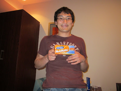
Oh HobNobs! This is the last picture of HobNobs you will see in this blog, I promise--unless I travel somewhere in the future and find them. So, last picture of HobNobs from New Zealand in March of 2011.