The second coolest (no pun intended) day in New Zealand, after the caves, was our tour of the Franz Josef Glacier. We drove from Takaka, back up that super scary road in drizzle. Luckily, it was only drizzle at that point; after that, it was pretty heavy rain the rest of the trip. With our Nissan Sunny wipers mostly working, we proceeded slowly, taking a full eight hours to get from Takaka to Franz Josef Glacier town. Of course, we took a route that was supposed to be one of the top ten scenic drives according to some list that must be wrong, and that took a little longer. From that drive, I decided two things: 1) scenic routes in the rain are not worth it, and 2) scenic routes are way better if you are not the driver. But we made it to our hotel, which was a renovated farm house with a sheep and plenty of cows nearby. They mooed all night.
Emily meeting one of the farm natives. The sheep was interested until she realized we didn't have food.
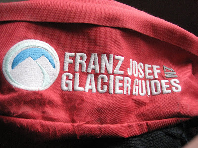
We awoke the next day to more drizzle and called the tour company to check if the weather would still permit our tour. They said yes so we headed to the office, where they gave people the option of rescheduling because the day could get wetter and colder than usual. After the chickens rescheduled, we received our gear, which covered us from head to foot: beanie, long waterproof and windproof jacket, wool mittens, waterproof pants, wool socks, boots, and crampons, which came in an red fanny pack. We then loaded onto the bus and headed to the start site.
To get to the glacier from the parking lot, we hiked about half a mile through a rain forest. There are three glaciers in the world that are situated right next to rain forests and two of them are in New Zealand: Franz Josef and Fox Glaciers. After the brief hike, we came out onto a field of broken rock called a moraine. Once upon a time, the glacier extended all the way to where we emerged from the forest. Later in time, during the glacier's retreat, the moraine was the bottom of a lake. But now it was dry enough to walk on. Our exit from the forest provided us our first view of the glacier, which didn't actually look that far away. However, we had a solid mile to hike in our boots that weren't all that comfortable.
Exiting the rain forest provided a spectacular view of the glacier's terminal face, which looked like a frozen river.
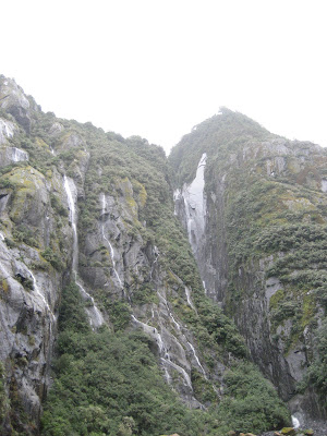
The hike across the moraine, though subject to a bit of drizzle, left little to be desired. The rocks on the valley floor had interesting textures and patterns from being ground under a glacier. The moraine was walled on both sides by steep granite mountains covered in rain forest foliage. Tens of waterfalls tumbled down both walls to the valley floor. And straight ahead was our target, a flowing mass of ice that wove its way down into the valley between two walls of granite.
 I took a lot of pictures of rocks because I was a bit mesmerized by them. If you think this picture is boring, be glad I didn't post all the pictures of rocks I took.
Here's what I remember about the glacier from the guide. The glacier consists of two main parts, the terminal face, which is what we could see and would hike, and the neve, which is where the glacier is fed. As moist air is blown in from the ocean to the west, it rises quickly as it hits the Southern Alps. Water condenses and snow falls onto the neve on 200+ days per year at an altitude of over 8,800 feet. This creates a huge ice pack under great pressure that is released by flowing into the valley, which is at an altitude of 800 feet. The huge drop in altitude that happens over about 6.5 miles and increases the temperature so the glacier is constantly melting on its terminal face. I don't remember how fast our guide said the glacier moves nowadays, but in the past, it has moved at rates of 70 cm per day, which is ten times faster than a normal glacier. The result is that it is constantly changing, melting and being resupplied by the neve. Come back a year later--completely different. A week later--very different. Two days later--the ice cave that was there before may be gone. It made what I always considered of a geologic feature (I know--it's made of ice, not rock) feel very alive, moving on a fast timescale for geology.
On our way across the moraine, we stopped to gaze at some of the more impressive waterfalls and the river that was exiting from the glacier. The river water was gushing from the opening, and it carried rocks that crashed into each other on their journey, giving the water a dirty but milky brownish color.
The river exited the glacier at high speed and low temperature. This picture also starts to put the glacier in perspective if you notice the tiny dots of people on the hill to the right.
We then proceeded to cross the rope fence that was meant to warn unguided visitors of danger. Uphill for twenty minutes and then it was time to put on our crampons, meaning it was time to get on the ice. They were surprisingly easy to lace up.

This is one of the signs warning people to take a guide with them.
Up a scree hill for a bit.
The view from the top of the valley made the first little hike well worth it.

We needed crampons because we were about to jump onto this.
Hiking up the ice was made much safer by the work of our guides earlier in the day. They spent hours each morning cutting steps into the ice, which allows groups to get to higher elevations. We were on the ice for around two hours, and in that time, we saw some really awesome formations and views. Even the pictures don't do them justice, but they are better than me typing about them. Another bonus was that the rain stopped, and it was pretty warm for the glacier. We even got rid of our hoods and mittens.
A little bit of perspective on how large the terminal face is. Notice the guy in red on the top in the center.

We saw an awesome ice cave, but weren't allowed to enter because it could collapse at any time.
After expecting to get super cold and wet, I was pleasantly surprised by the good weather and how spectacular the entire glacier experience was. I would return in a heartbeat to see it again because it would be a completely different surface to explore. Happy with our day, we wandered around town and eventually headed to bed, sleeping through the lowing of the cows. Our next big stop was fiordland, which proved to be every bit as impressive as I imagined it would be.


